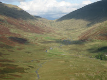
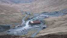
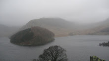
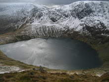
I like to spend the odd night out in the mountains the most recent being in the Priest's Hole Cave on Dove Crag in June and September last year. This year there are two more caves to spend the night in. One is on Castle Crag called Millicans Daltons cave and the other is a cave which is known to only a handful of people non of whom will confirm its location but whom have left clues in their writings and photo's. The cave is situated on a crag and it is entered by a small hole but once inside it is well fitted out. The story is it was kitted out by a Leeds university lecturere whom was building a little hideaway for himself but it was discovered by some rock scramblers. The few photos of the cave show it to have 3 wooden berths for your sleep bags, a fireplace with a built in fleu and a storage cave for supplies. Everything you need for a night in the mountains. The cave came to my attention when I spent the night in the Priest's Hole last September with my mate Spetsnatz. We met a monkey hanger out with his dog and he joined us for a brew and during the conversation he asked us if we had ever heard of the $%*# cave on @#& Crag? We hadn't but following 4 months of gathering information, examining the pictures for clues and the fact Trail magazine confirmed it's existence Spetsnatz and I went on a recce to find it. I can not mention any place names of where we parked or climbed as we too want this place to remain a secret and retain it's mysterious identity. As it happens we did not find it but we know we were on the right crag on the right mountain. If you were to enter this cave name into Google you would only get three entries and they report that you could be standing by the enterance and yet non the wiser to it being there.The snow didn't help us in our search but we will be back in the spring with two more clues and confirmation as to what height it can be found within.
Sunday, January 25, 2009
Monday, December 01, 2008
Whitby and chip shops.


Picture 2 The Abbey and St Mary's church above Whitby
Picture 3 St Marys church on the hill and replica of Cooks ship the Endeavour
Picture 4 Whitby from St Mary's churchyard
Picture 5 Whitbt Abbey ruins
Everyone knows England's national dish is fish 'n' chips, preferably wrapped up in a newspaper and smothered in salt 'n' vinegar. The trouble is most people whom visit England from oversea's only see London and the South East of the country. Now whilst the south east has many wonderful treasures for the visitor to enjoy, it is lacking in good chip shops. I speak from experience in saying that London has some terrible chip shops in the tourist area's which leave the visitor wondering what all the fuss is about. In saying that however,if you visit Hainalt Road in Leytonstone East London there is a very nice chippy ran by a Chinese chap called Michael which I would recommend. The best chip shops in England are generally found in the north and one town with it's fair share of excellent chip shops is a small Yorkshire town situated at the mouth of the River Esk named Whitby. Whitby is a pleasant little harbour town famous for a number of things but mostly for Captain Cook whom was an English explorer, navigator and cartographer whom was the first to map Newfoundland in Canada prior to making three voyages to the Pacific Ocean during which he achieved the first European contact with the eastern coastline of Australia and the Hawaiian Islands as well as the first recorded circumnavigation of New Zealand. Also on offer in Whitby situated high above the town are the remains of it's abbey built in 657 AD and destroyed by Danish Vikings in 867 along with pleasant beaches, narrow olde English cobbled streets, great local shops and as stated earlier, fantastic chippy's.
Whitby offers the visitor more than history; its situation is superb in the middle of one of Britain’s most delightful stretches of coast, with cliffs and fine bays interspersed with picturesque fishing villages. The noble Abbey may be a beautiful ruin, but the Parish Church of St Mary, dating partly from 1110, and reached by 199 steps cut in the cliff, is still very much a part of the town.
Monday, November 17, 2008
The Stadium of Light & Joan's Cafe
Photo's
1 - Joan's cafe outside the stadium
2 - The Wearmouth Colliery wheel with Bethany, Zahava, Sammy Jo & Bailey.
3 - My two young lion cubs in the Stadium of Light
4 - My two young lion cubs before a friendly with Juventus
What am I doing showing you all these wonderful scenic and historic sites in England without first showing you what I think is the coolest place in England. The Stadium of Light in Sunderland in England's beautiful north east. As a young lad growing up in Durham I would watch Sunderland every home game at their old stadium Roker Park I was first taken there in 1976 by my Grandad although I had been introduced to his beloved Sunderland as a toddler prior to their 1973 F.A cup victory over Leeds United at Wembley. His team became my team the only difference being that when he was a youth Sunderland were winning everything, in my lifetime I have known them win the F.A cup once with plenty of promotion and relegation battles thrown in. Non the less the motto of my Grandads regiment the Durham Light Infantry is ' faithful' and that is what I am to my team. I live in the south of England now having moved away from Durham city in 1995 but my two young daughters are now keen Sunderland fans and I like to take them to a match or two when we travel up to visit Grandma in Durham. Sunderland moved from their old stadium Roker Park to the Stadium of Light in 1997 and although I have many memories of being frozen by the winds coming in from the North Sea into Roker whilst watching Stan Cummings, Gary Rowell & Marco Gabiadinni amongst many other Sunderland legends I much prefer the new stadium and its facilities although I miss being on the sea front.The Stadium of Light is on the banks of the River Wear and was erected on the site of the old Monkwearmouth deep sea colliery and it has become the cathedral of the city as Sunderland does not have an actual cathedral to correctly call itself a city. It's capacity is 49,000 with plans to raise it to 66,000 when the club establishes itself as one of the English greats again hopefully this will not be too long. With the stadium being built on the site of the old colliery the club has incorporated some links to it on their new crest which replaced the fans favourite in 1997. The old crest had a ship on it signifying that Sunderland was a shipbuilding town , it was at one point the biggest shipbuilding town in the world but with the decline of ship building in England Sunderland ceased to function with this grand title. In 1997 with the new stadium, Sunderland released it's new crest, it is divided into four quarters; the upper right and lower left featured the traditional red and white of Sunderland. The upper left section features the Penshaw Monument and the lower right section shows the Wearmouth Bridge. A colliery wheel lies at the top of the crest, to commemorate County Durham's mining history, and also the land the Stadium of Light lies on, which was formerly Monkwearmouth Colliery. The crest also contains two lions, the black cats of Sunderland and a banner reading the club's motto Consectatio Excellentiae which means In pursuit of excellence. Prior to WW2 Sunderland were league champions six times: in 1892, 1893, 1895, 1902, 1913, and most recently in 1936, when they became the last team wearing striped shirts to win the league. They were elected into The Football League in 1890, becoming the first team to join after the league's birth in 1888. Sunderland stayed in the top flight until 1958, a record which only Arsenal, in 1992, surpassed. They have a long-standing rivalry with local team Newcastle United whom are known by Sunderland fans as 'the skunks' because of their black and white striped shirts.The Tyne-Wear derby has been contested since 1898 but the rivalry goes back to the English civil war when Newcastle was a royalist city whilst Sunderland was a parliamentarian town. A Davy lamp monument stands outside the stadium, as a reminder of the Monkwearmouth Colliery that the stadium was built on. The mascot of Sunderland A.F.C is the black cat there is a long historical link between Black Cats and Sunderland; including the "Black Cat Battery", a battery gun based on the River Wear. Raine's "Eye Plan" of c.1785–90 shows two of the (ultimately four) gun batteries on the south side of the Wear which guarded the rivermouth during the Napoleonic wars.This battery site would later evolve into Militia Barracks during the course of the nineteenth century. An annotation to the 1984 published version of Raine's Eye Plan states that one of the two batteries was named the John Paul Jones Battery after the American naval hero who sailed down the English East coast in 1779 with a squadron of warships intending to disrupt the coal trade. In 1805 the battery was manned by local militia, the Sunderland Loyal Volunteers, one of whom was a cooper by trade named Joshua Dunn. He, it was said, "fled from the howling of an approaching black cat, convinced by the influence of the full moon and a warming dram or two that it was the devil incarnate". From that point onwards the John Paul Jones Battery was known as the Black Cat Battery. Sunderland fans or Mackems as they are known have proved to be the noisiest fans in the English football league for three years in a row in a study carried out by phone number service 118118 ,they came out on top in terms of the sound level and frequency of their chants. The average peak volume measured at The Stadium of Light was 129.2 decibels – almost as loud as a jet. Why not come along next time your in the area tickets can be purchased from www.safc.com. When you visit the stadium you will find Joan's cafe I visit here for a pre match meal every time I attend a game, it's not posh it's a traditional working class environment that the miners & shipbuilders of bygone times would have approved of , the food and friendly service is legendary & I will be in there this coming Saturday with my young lion cubs and their two cousins for the West Ham match. Haway the Lads.
Thursday, October 16, 2008
England's white Cliffs
Picture 2- Looking west from the chalky beach of Birling Gap towards Cuckmere Haven.
On the south east coast of England you will find mile after mile of beautiful white chalk cliffs, these have become symbolic of England's separation and independence from mainland of Europe and are often referred to as the White cliffs of Dover or Beachy Head however they stretch far beyond these two locations. Recently I took a short drive down to my favourite part of the white cliffs in order to walk along them, enjoy the views and partake of a swift half in a rather nice pub in the area. I managed to do all three and thoroughly enjoyed myself. I parked at the small settlement of Birling Gap which is just west of Beachy Head and walked along the beach in a westerly direction towards Cuckmere Haven. It was only about a mile in distance clambering over shingle, rocks and large chalk boulders smoothed by the sea but it was awe inspiring with massive white chalk cliffs to my right towering above me and an English Channel tide rapidly rising to my left. As you can imagine I did this part of the walk with some urgency.
Arriving at Cuckmere Haven where the River Cuckmere and it's canal overflow enter the sea one can wade over to the lifeboat cottages on the other side depending on the tide and depth of course and take in it's most famous view. From the cottages you can follow the canal for around 1/2 a mile inland spotting kingfisher, stork and various other species of bird until you reach a very nice pub called the Golden Galleon. It has a lovely log fire, serves fine food and has a pleasant garden where one can sit under an apple tree whilst enjoying the tipple of their choice. www.vintageinn.co.uk/thegoldengalleonseaford/
Once refreshed you can head back to Cuckmere Haven by crossing the Exceat bridge and following the winding River Cuckmere back to the shingle beach spotting WW2 sea defences along the way. Arriving here you turn east climbing up the grassy banks to the top of the cliffs as you follow the clifftops all the way back to Birling Gap remembering not to get too close to the edge.
Arriving at Cuckmere Haven where the River Cuckmere and it's canal overflow enter the sea one can wade over to the lifeboat cottages on the other side depending on the tide and depth of course and take in it's most famous view. From the cottages you can follow the canal for around 1/2 a mile inland spotting kingfisher, stork and various other species of bird until you reach a very nice pub called the Golden Galleon. It has a lovely log fire, serves fine food and has a pleasant garden where one can sit under an apple tree whilst enjoying the tipple of their choice. www.vintageinn.co.uk/thegoldengalleonseaford/
Once refreshed you can head back to Cuckmere Haven by crossing the Exceat bridge and following the winding River Cuckmere back to the shingle beach spotting WW2 sea defences along the way. Arriving here you turn east climbing up the grassy banks to the top of the cliffs as you follow the clifftops all the way back to Birling Gap remembering not to get too close to the edge.
Sunday, June 29, 2008
Dove Crag & The Priests Hole
2- View from the cave to Brothers Water.
3- View from the back of the cave.
4- Looking up to Dove Crag from Hartsop Hall
Dove Crag is a peak situated in the Patterdale area of Cumbria’s Lakeland. It is only 2603 ft high but is blessed with many beautiful features one of which is a cave known as ‘The Priests Hole’ that can be found 2/3 of the way up on it’s north east facing crag. The cave is a popular place for fell walkers to bed down for the night as it provides good shelter with fantastic views towards the Angletarn Pikes, High Raise and many other Lakeland peaks.
To get to the cave however one must scramble up Dove Crag’s north east face but it is well worth the effort. Once in the cave you will find a metal strong box which is generally stocked with goodies that previous climbers have left behind for you , when I arrived I found in the box a bottle of whisky with some candles, raisins, gas canisters and an emergency sleeping blanket wrapped in an emergency bag as well as a bag of self heating food. There is also a visitors book for climbers to leave their signature, reflections & doodles which provides an interesting read.
I ascended Dove Crag from the route Wainwright gives you starting from Hartsop Hall following Hartsop Beck through a very scenic area known as the Stangs , The scenery was of the of lushest green patterned with rock, crag, bracken & a small wood that actually produces Hazelnuts in October. Hartsop Beck provided some wonderful waterfalls and tranquil area’s for one to bed down for the night weather permitting.
Once you reach the area known as Hunsett Cove the ascent becomes quite steep but the National Trust has provided a path using rock & scree as improvised steps, Dove Crag towers above you on your left until you reach a small tarn where you can traverse south along the crag up to the Priest Hole where you can crack open s swift one and take in the magnificent scenery below. Dove Crag remains one of my favourite climbs and I can’t wait to do it again but next time explore a lot more of it’s surrounding area, I may even carry my portable barbeque up there, if your in the vicinity and you get a wiff of honey & mustard sauce climb up and join me. ( Bring a bottle)
To get to the cave however one must scramble up Dove Crag’s north east face but it is well worth the effort. Once in the cave you will find a metal strong box which is generally stocked with goodies that previous climbers have left behind for you , when I arrived I found in the box a bottle of whisky with some candles, raisins, gas canisters and an emergency sleeping blanket wrapped in an emergency bag as well as a bag of self heating food. There is also a visitors book for climbers to leave their signature, reflections & doodles which provides an interesting read.
I ascended Dove Crag from the route Wainwright gives you starting from Hartsop Hall following Hartsop Beck through a very scenic area known as the Stangs , The scenery was of the of lushest green patterned with rock, crag, bracken & a small wood that actually produces Hazelnuts in October. Hartsop Beck provided some wonderful waterfalls and tranquil area’s for one to bed down for the night weather permitting.
Once you reach the area known as Hunsett Cove the ascent becomes quite steep but the National Trust has provided a path using rock & scree as improvised steps, Dove Crag towers above you on your left until you reach a small tarn where you can traverse south along the crag up to the Priest Hole where you can crack open s swift one and take in the magnificent scenery below. Dove Crag remains one of my favourite climbs and I can’t wait to do it again but next time explore a lot more of it’s surrounding area, I may even carry my portable barbeque up there, if your in the vicinity and you get a wiff of honey & mustard sauce climb up and join me. ( Bring a bottle)
Sunday, April 06, 2008
England's Highest.
aspects to it, my own favourite being on the way up to the summit from Wasdale Head, about 1/3 of the way up you come to an open expanse of scree and cliff known as Hollow Stones. This is a fantastic place to bivvy
down for the night with a range of overhanging boulders for shelter. The summit is not visible from this point one must continue past Hollow stones by either Mickledore on the right approach (my favourite) as it provides one with a nice little scramble up a cliff before turning left and and following through the boulders to the summit, or the approach to the left of Hollow stones via Lingmel Col which is a winding path through rock & scree. Once on the summit you (depending on the weather) are subject to wonderful views of Great Gable, Crinkle Crags, Scafell , Bowfell even Skiddaw & Blencathra with Derwent Water. I ascended from Wasdale head via Hollow Stones and returned to Wasdale head via Broad Crag, Esk Hause and Sprinkling Tarn. From Sprinkling Tarn to Wasdale Head I followed Lingmell Beck which gave majestic views to my right of the Napes high above me on Great Gable. Right at the end of this walk is of course the Wasdale Head Inn.
The photo's are from top to bottom. 1.The view from Hollow Stones of Pulpit Rock & Mickledore.2.Looking over Piers Gill onto Great gable, the bank of scree down the centre of Great Gable is called Great Hell Gate,I came down this when I did Great Gable (mostly on my bum). 3.Me on top of Skafell Pike with Skafell behind me. 3.Pulpit Rock from Mickledore..
Friday, March 28, 2008
Staithes Car Park


Recently I visited the small hamlet of Staithes on the Cleveland/North Yorkshire border and what a day to visit. It was during a period when little old England was getting hammered by strong winds from the Atlantic, however the wind kind of enhanced my visit and added to the enjoyment of being there especially with regard to the waves that the North Sea was sending against the rocks and breakwater of Staithes harbour. Staithes is a seaside village which is divided between Yorkshire & Cleveland by Roxby Beck with about 90% of Staithes being in North Yorkshire. In times past it was one of the largest and most productive fishing centres in England by the North Sea, however nowadays it is largely a tourist destination due to it's attractive olde England appearance. Staithes is noted for its sheltered harbour, bounded by high cliffs and two long breakwaters, a mile to the north is Boulby cliff which is the highest cliff in England. The cliffs around Staithes also are popular with sea birds and it can get a bit noisy. Staithes population has dwindled due to a lot of the cottages being owned by people from Leeds and York for example and during the winter it can appear like a ghost town with few visitors but this is a great time to visit if you can handle the stormy weather. Staithes still maintains its tradition and many of the local women still wear their Staithes bonnets (some can still be bought today in the Gift Shop in Staithes!) for the annual nightgown parade, and the Fisher Men's choir is still going strong along with local participation in the local RNLI Lifeboat. In 1745-1746, Staithes's most famous son (born in Marton near Middlesbrough), the young James Cook worked in Staithes as a grocer's apprentice where he first gained his passion for the sea. Later he moved to Whitby where he joined the Royal Navy. William Sanderson's shop, where Cooky worked, was destroyed by the sea, but parts were recovered and incorporated into "Captain Cook's Cottage". A local family has lived here for a number of generations. Should you find yourself in Staithes make sure you visit the Royal George or the Cod & Lobster for a pint of the local and a bite to eat. One last thing Staithes is famous for , it has the most dangerous car park in England as can be seen by my picture. When I was there a local resident by the name of Sandra climbed down to investigate this strange sight. ( I suspect she's a menber of the Royal Marines Reserve but the secret is out now) Sunday, March 23, 2008
Great Gable


Great Gable is a beautiful mountain situated at Wasdale Head in Cumbria opposite the Scafell Masiffs and adacent to Black Sail Pass which nestles between the mighty Pillar and haystacks. I chose to tackle it from Seathwaite rather than from Wasdale Head as I had just recently climbed Scafell Pike from Wasdale Head. The climb started with a scramble up Sour Milk Gill for about 1000 ft followed by a long drawn out climb between Base Brown and Brandreth to ascend Green Gable. Green Gable is to the rear of Great Gable and it gives on a clear day wonderful views of Gable Crag on the back of Great Gable along with a fantastic view down the Black Sail Pass and the River Liza. From Green Gable we dropped slightly to the south and then began the climb up Great Gable. The weather remained unpredictable with cloud and rain followed by sunny spells but I was able to see opposite Sprinkling Tarn and further on the summit of Scafell Pike. Finally reaching the top I was met by a strong wind which denied me being able to boil up some water for a cup of tea. The top of Great Gable indicates that it is a war memorial, and it is in fact the largest memorial in Europe with a large number of climbers grouping on its summit each rememberance Sunday. Down below to the south is Wastwater and Wasdale head with the Wasdale Head Inn, home of the biggest liar competition. http://www.wasdaleheadinn.co.uk/.
Whilst on the top I slipped and twisted my ankle which made it difficult coming down especially in the dark but hopefully I will find the time to visit Great Gable again to check out its world famous needles on the south traverse. Pictures include the sun going down over Wast water, a view down Black Sail Pass , myself on Great Gable & myself on Green Gable with Great Gable crag behind me.
Labels:
climbing,
cumbria,
fellwalking,
lake district,
mountains
Sunday, March 16, 2008
Not your normal High Street


This last week I have been up in England's Lake District in the county of Cumbria. Cumbria , situated in the north west is England's most mountainous county filled
with wonderful peaks with names suchas Haystacks, Pillar and Hellvelyn to mention but a few, They are not mountains on the scale of the Himalaya's or Southern Alps but non the less in my opinion they are just as beautiful,if not more so. There is so much history to be found in these English mountains from shepherds and their flocks to slate miners. This week I went to climb a mountain known simply as 'High Street' in the vicinity of Haweswater. The name High Street does not imply that you will find a butchers or bakers on the summit rather it takes you back to the day when it's summit was a high up Roman road linking their garrisons at Ambleside and Brougham and on the south side of the mountain lies the Troutbeck slopes where Scotch invaders were repulsed by the shepherds, dalesmen and farmers whom made the summit their playground and feasting place during their annual horse racing meets. I made my ascent via Rough Crag which at first is a pleasant climb with the odd scramble thrown in to get your hands dirty however the English weather was quite bad at the time with high winds from the Atlantic buffeting us as we ventured into exposed area's. We made it into the snow about half way up Long Stile which is around 100 yards from the top but due to the severe winds in this unsheltered area we decided to come back down via Blea tarn. No sooner had we turned back when the summit became a white out with a snow storm coming in from the south. The climb down via Blea Tarn leads one to a lovely body of water with a small dam surrounded by the mountain, and a gentle walk down to Haweswater following Blea Water Beck through gorgeous coloured fells with a number of waterfalls thrown in to impress. If your interested in this part of England may I recomend the books of A Wainwright or the DVD's of Wainwright's walks presented by Julia Bradbury.
Thursday, March 13, 2008
High Cup Nick


One of the many treasures to be found on England's Pennine Way, a rugged walk that will take you down the hilly spine of England, is High Cup Nick. It is situated on the border's of Cumbria & County Durham and can be described as 'A deep chasm on the Pennine fellside, this famous nick, a dramatic geological formation at the top of High Cup Gill is part of the well-known Whin Sill, and overlooks the best glaciated valley in Northern England. Here you can see the grey-blue dolerite crags which also form High Force and Cauldron Snout (Waterfalls)'. I walked from the village of Dufton ,north to Maize Beck following it east to join the Pennine Way and on to High Cup Nick. It is an awesome sight and pictures simply do no give you the scale and majesty of it. It is a windy place so one needs to be careful when near the edges in certain area's depending on which direction the wind is blowing but it has to be seen from all 3 sides followed by a climb down into its deep chasm. You can finish your walk back in Dufton followed by a swift half in the pub.
Monday, February 19, 2007
Dungeness
Tuther day I took my lion cubs down to the south coast, we went to Dungeness. Let me tell you a little bit about Dungeness. It's the site of one of the largest expanses of shingle in the world and the variety of wildlife in the area extends to over 600 differing types of plant, making it one of the best places in England to find insects such as moths, bees, beetles & spiders. The flooded gravel pits behind the shingle provide habitat for many migratory coastal birds. Another thing situated on the shingle is a massive Nuclear power station which oddly enough does not actually look out of place, in a strange way it enhances what Dungeness is, or at least it does to me. There are two lighthouses at Dungeness which warn ships not to get too close, as the English channel is the worlds busiest shipping lane. There is a nice little pub by the name of the Brittania inn, the fish & chips are 'morish' and the liquid refreshment very nice. We had munch then took a stroll along the shingle, beach fishermen were casting their lines out to see and the waves were canny high, it was a beautiful sight, my young cubs enjoyed running at he waves and collected some lovely sea shells left over by the fishing boats which lie in various states of repair along the shingle. Some of these boats are obviously still in use but others have seen better days and remain alongside their delapadated huts reminding visitors of Dungenesse's rich heritage. We walked around the boats and other relics of the fishing trade that can be found on the shingle and vowed to come back in the summer for a picnic and to collect more shells. I may also pop into the Brittania for a swift half. If you come to Dungeness you must also check out some fo the dwellings littered along the road, especially Prospect and Ness cottages, they have done some remarkable things in their open gardens using items washed up on the beach along with fishing relics, very artistic indeed. Dungeness is well worth a visit, I anticipate many more visits in the coming years. Why not give it a try!
Monday, January 15, 2007
Treasures of 2006
We are now well into 2007 and I have been making plans on where in England to take my young lion cubs this coming year, I have many places in mind especially up in the North East , some we have visited before and some we haven't. I will of course be posting our adventures on this blog but lets go back to last year. In 2006 my young cubs stood on the south coast of England at the symbolic white cliffs of Beachy Head they also stood on England's remote northern border at the windswept Carters Bar, in between these two rugged symbols of our land they saw mighty castles, magnificent cathedrals, beautiful beaches, green hills, ruins, traditional villages, fayre's and events & even the battle of Hastings on Senlac ridge. To look back on the last year I have posted a number of pictures with this entry to give you a taste of what our England has to offer you. Come to England, It's really cool ! By the way , the pictures are of Bodiam castle, Dunstaburgh castle ruins, Angel of the north, Hever castle, the English border at Carters Bar, Lindisfarne castle & the white cliffs of Beachy head.
Subscribe to:
Posts (Atom)